Waihona:National Atlas of the USA 1970 - Pacific Outlying Areas.jpg

Ka nui o kēia nāmua: 800 × 544 mau pikela. Other resolutions: 320 × 218 mau pikela | 640 × 435 mau pikela | 1,024 × 696 mau pikela | 1,280 × 871 mau pikela | 2,560 × 1,741 mau pikela | 4,170 × 2,836 mau pikela.
Waihona kumu (4,170 x 2,836 pikela, nui waihona: 2.04 MB, ʻano MIME: image/jpeg)
Hōʻuluʻulu manaʻo
| Description |
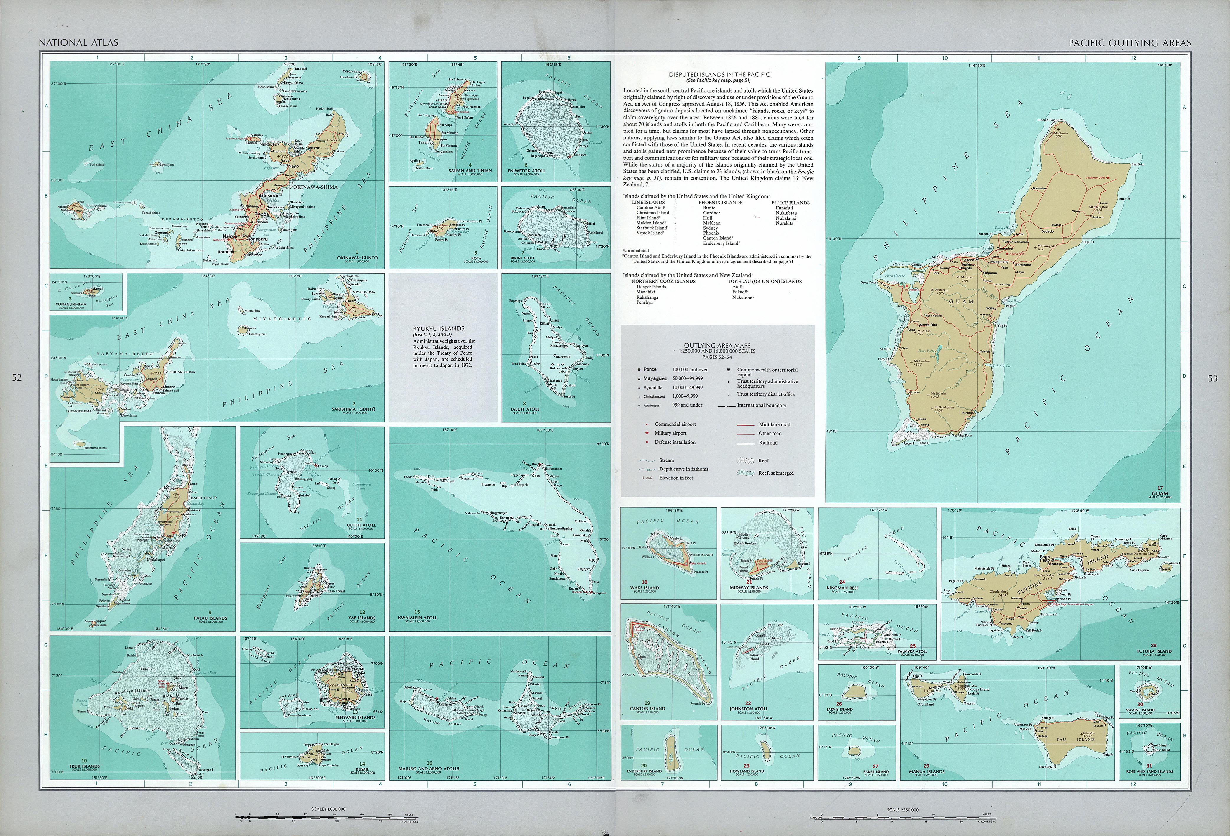
English: National Atlas of the United States, page "Pacific Outlying Areas", with map insets (all uploaded separately) |
| Date | |
| Source | https://www.lib.utexas.edu/maps/national_atlas_1970/ca000040.jpg |
| Author | United States Department of the Interior |
| Other versions |
|


Laikini
| This work is from the Library of Congress. According to the library, there are no known copyright restrictions on the use of this work. |  |
Mōʻaukala waihona
Kāomi ma ka lā/hola no ka nānā ʻana i ka waihona ma kēlā manawa.
| Lā/Hola | Kiʻiliʻi | Nā Nui | Mea ho‘ohana | Kaumanaʻo | |
|---|---|---|---|---|---|
| okamanawa | 13:16, 17 'Okakopa 2016 | | 4,170 × 2,836 (2.04 MB) | Mauerquadrant | Reverted to version as of 19:25, 16 October 2016 (UTC) |
| 13:15, 17 'Okakopa 2016 |  | 492 × 301 (84 KB) | Mauerquadrant | Cropped 6 % horizontally and 11 % vertically using CropTool with precise mode. | |
| 13:13, 17 'Okakopa 2016 |  | 521 × 339 (93 KB) | Mauerquadrant | Cropped 88 % horizontally and 88 % vertically using CropTool with precise mode. | |
| 19:25, 16 'Okakopa 2016 |  | 4,170 × 2,836 (2.04 MB) | Ratzer | User created page with UploadWizard |
Nā Hana waihona
ʻAʻohe ʻaoʻao e loulou i kēia waihona.
Global file usage
The following other wikis use this file:
- Usage on de.wikipedia.org