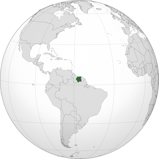
Waihona:SUR orthographic.svg

Size of this PNG preview of this SVG file: 550 × 550 mau pikela. Other resolutions: 240 × 240 mau pikela | 480 × 480 mau pikela | 768 × 768 mau pikela | 1,024 × 1,024 mau pikela | 2,048 × 2,048 mau pikela.
Waihona kumu (Waihona SVG, 550 x 550 mau pikela, nui waihona: 1.11 MB)
Mōʻaukala waihona
Kāomi ma ka lā/hola no ka nānā ʻana i ka waihona ma kēlā manawa.
| Lā/Hola | Kiʻiliʻi | Nā Nui | Mea ho‘ohana | Kaumanaʻo | |
|---|---|---|---|---|---|
| okamanawa | 15:16, 8 Mei 2023 |  | 550 × 550 (1.11 MB) | WeaponizingArchitecture | Stop it please. |
| 22:38, 6 Mei 2023 |  | 512 × 512 (903 KB) | SurinameCentral | Reverted to version as of 17:32, 7 April 2023 (UTC) | |
| 00:45, 5 Mei 2023 |  | 550 × 550 (1.11 MB) | WeaponizingArchitecture | Stop adding in surinames disputes. It does not goven this land | |
| 17:32, 7 'Apelila 2023 |  | 512 × 512 (903 KB) | SurinameCentral | Reverted to version as of 13:41, 26 March 2023 (UTC), This image is being used on a Suriname Specific Page. | |
| 16:35, 7 'Apelila 2023 |  | 550 × 550 (1.11 MB) | Kordas | Tigri Area is not Suriname | |
| 13:41, 26 Malaki 2023 |  | 512 × 512 (903 KB) | SurinameCentral | Background Transparency Corrected | |
| 23:31, 24 Malaki 2023 |  | 512 × 512 (872 KB) | SurinameCentral | Suriname Highlight corrections | |
| 20:06, 8 Iulai 2012 |  | 550 × 550 (1.11 MB) | Addicted04 |
Nā Hana waihona
Loulou kekahi ‘ao‘ao i kēia waihona:
Global file usage
The following other wikis use this file:
- Usage on ar.wikipedia.org
- مستخدم:جار الله/قائمة صور مقالات العلاقات الثنائية
- العلاقات الأمريكية السورينامية
- العلاقات الأنغولية السورينامية
- العلاقات السورينامية الكورية الجنوبية
- العلاقات الإريترية السورينامية
- العلاقات السورينامية السويسرية
- العلاقات الألمانية السورينامية
- العلاقات السورينامية الليختنشتانية
- العلاقات البوليفية السورينامية
- العلاقات السورينامية الموزمبيقية
- العلاقات الألبانية السورينامية
- العلاقات البلجيكية السورينامية
- العلاقات الإثيوبية السورينامية
- العلاقات البيلاروسية السورينامية
- العلاقات السورينامية الطاجيكستانية
- العلاقات الروسية السورينامية
- العلاقات الرومانية السورينامية
- العلاقات الأرجنتينية السورينامية
- العلاقات السورينامية الغامبية
- العلاقات السورينامية القبرصية
- العلاقات السورينامية السيراليونية
- العلاقات السورينامية النيبالية
- العلاقات السورينامية الليبيرية
- العلاقات التشيكية السورينامية
- العلاقات السورينامية الميانمارية
- العلاقات السورينامية الكندية
- العلاقات السعودية السورينامية
- العلاقات الزيمبابوية السورينامية
- العلاقات الإسرائيلية السورينامية
- العلاقات البالاوية السورينامية
- العلاقات السورينامية المالية
- العلاقات السورينامية النيجيرية
- العلاقات اليمنية السورينامية
- العلاقات السورينامية الفانواتية
- العلاقات الغابونية السورينامية
- العلاقات البنمية السورينامية
- العلاقات السورينامية الكوبية
- العلاقات الجورجية السورينامية
- العلاقات التونسية السورينامية
- العلاقات السورينامية الكورية الشمالية
- العلاقات الهندية السورينامية
- العلاقات اليابانية السورينامية
- العلاقات الإيطالية السورينامية
- العلاقات السورينامية الناوروية
- العلاقات الأسترالية السورينامية
- العلاقات الزامبية السورينامية
- العلاقات السورينامية الفيجية
- العلاقات المارشالية السورينامية
- العلاقات الأذربيجانية السورينامية
- العلاقات السودانية السورينامية
View more global usage of this file.