Waihona:Tenerife LANDSAT-Canary Islands.png

Ka nui o kēia nāmua: 800 × 600 mau pikela. Other resolutions: 320 × 240 mau pikela | 640 × 480 mau pikela | 1,024 × 768 mau pikela | 1,280 × 960 mau pikela | 2,560 × 1,920 mau pikela | 6,000 × 4,500 mau pikela.
Waihona kumu (6,000 x 4,500 pikela, nui waihona: 21.28 MB, ʻano MIME: image/png)
| Description |
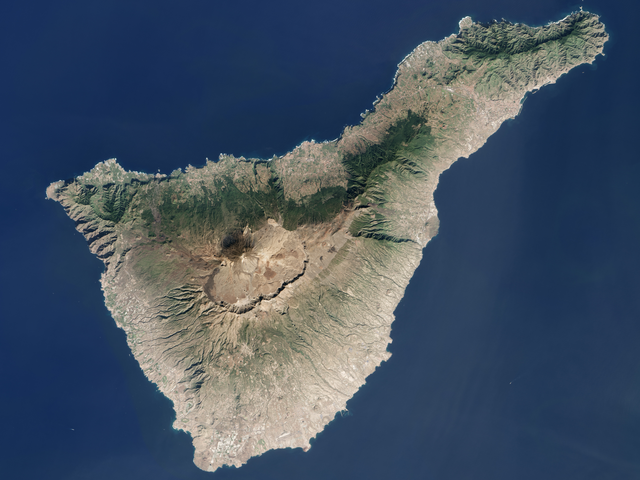
English: Tenerife Island (Canary Islands, Spain) from LANDSAT7 satellite of NASA.
Español: Isla de Tenerife (Islas Canarias, España) desde el satélite LANDSAT7 de la NASA.
|
| Date | Unknown date |
| Source | NASA's World Wind software (images provided by NASA) |
| Author | NASA |
| This image is in the public domain because it is a screenshot from NASA’s globe software World Wind using a public domain layer, such as Blue Marble, MODIS, Landsat, SRTM, USGS or GLOBE.
|
 |
Mōʻaukala waihona
Kāomi ma ka lā/hola no ka nānā ʻana i ka waihona ma kēlā manawa.
| Lā/Hola | Kiʻiliʻi | Nā Nui | Mea ho‘ohana | Kaumanaʻo | |
|---|---|---|---|---|---|
| okamanawa | 11:35, 21 Iune 2018 | | 6,000 × 4,500 (21.28 MB) | Olo72 | =={{int:license-header}}== {{PD-USGov-NASA}} https://earthobservatory.nasa.gov/IOTD/view.php?id=88659 |
| 22:09, 20 Kepakemapa 2007 |  | 1,022 × 701 (841 KB) | Pepelopex | {{Information |Description= {{en|Tenerife Island (Canary Islands, Spain) from LANDSAT7 satellite of NASA. * Coordinates: -16.52792W 28.29799N}} {{es|Isla de Tenerife (Islas Canarias, España) desde el satélite LANDSAT7 de la NASA. * Coordenadas: -16.5279 |
Nā Hana waihona
Loulou kekahi ‘ao‘ao i kēia waihona:
Global file usage
The following other wikis use this file:
- Usage on af.wikipedia.org
- Usage on an.wikipedia.org
- Usage on az.wikipedia.org
- Usage on bat-smg.wikipedia.org
- Usage on cs.wikipedia.org
- Usage on de.wikipedia.org
- Usage on el.wikipedia.org
- Usage on es.wikipedia.org
- Usage on es.wikivoyage.org
- Usage on fo.wikipedia.org
- Usage on fr.wikipedia.org
- Usage on fr.wiktionary.org
- Usage on gd.wikipedia.org
- Usage on hr.wikipedia.org
- Usage on ht.wikipedia.org
- Usage on hu.wikipedia.org
- Usage on id.wikipedia.org
- Usage on is.wikipedia.org
- Usage on jv.wikipedia.org
- Usage on ku.wikipedia.org
- Usage on lad.wikipedia.org
- Usage on la.wikipedia.org
- Usage on lmo.wikipedia.org
- Usage on lt.wikipedia.org
- Usage on mi.wikipedia.org
- Usage on mk.wikipedia.org
- Usage on ms.wikipedia.org
- Usage on nn.wikipedia.org
- Usage on no.wikipedia.org
- Usage on pms.wikipedia.org
- Usage on ru.wikipedia.org
- Usage on sa.wikipedia.org
- Usage on scn.wikipedia.org
- Usage on sc.wikipedia.org
View more global usage of this file.